Automobile
What is GPS
INTRACK GPS Vehicle Tracking System
Vehicle Tracking Benefits
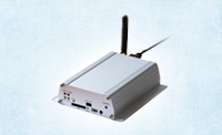
Features-INTRACK Hardware
Features- INTRACK Application
Key Benefits
Basic Reports

The Global Positioning System (GPS) is a global navigation satellite system (GNSS) developed by the United States Department of Defense and managed by the United States Air Force 50th Space Wing. It is the only fully functional GNSS in the world, can be used freely by anyone, anywhere, and is often used by civilians for navigation purposes. It uses a constellation of between 24 and 32 medium Earth orbit satellites that transmit precise radiowave signals, which allow GPS receivers to determine their current location, the time, and their velocity. Its official name is NAVSTAR GPS.
Since it became fully operational on April 27, 1995, GPS has become a widely used aid to navigation worldwide, and a useful tool for map-making, land surveying, commerce, scientific uses, tracking and surveillance, and hobbies such as geocaching. Also, the precise time reference is used in many applications including the scientific study of earthquakes and as a required time synchronization method for cellular network protocols such as the IS-95 standard for CDMA.
A GPS receiver receives information from these satellites and uses it to locate itself. GPS works best in open environments, with an accuracy of a few meters under good conditions.
GPS tracking with INENS is based on GPS receivers that have a connection to the Internet so that they can transmit their position information to a intrack Server. Common objects to track include persons, vehicles, animals and valuable assets.
To be able to track an object you need a GPS device with an Internet connection, access to a Intrack Server and a web browser. This is depicted below:
![]()
The process of tracking an object can be simplified to three steps:
1. Locating the object: This is done by placing a GPS on the object. There are mobile phones with built-in GPS, small GPS devices dedicated for personal tracking, fixed mount GPS devices for vehicle tracking, etc. As long as the GPS is turned on its position information is constantly updated, so “it knows where it is”.
2. Sending the objects position information to a server: By connecting the GPS to the Internet it's position information can be sent to a Intrack Server in real time. This is usually done over GPRS in a mobile network using a standard mobile subscription or over a satellite communication link in areas without mobile network coverage. A dedicated GPS tracking device has both a GPS and a mobile subscription or satellite module built in for this purpose. Other devices with an Internet connection, such as mobile phones, PDAs or laptops can of course also be used as clients.
3. Reporting the objects position: When the objects position has been sent to the INTRACK Server it can be seen in a web browser. Security settings define who can see what. Depending on the user needs the objects position can be shown on a map in real time, sent as emails or SMS. Historical reports can be created showing track history, alerts can be triggered on object behaviour, etc. There are additional things to consider in this process, such as; security around who should be able to see what objects; historical track storage and retrieval; management of operator roles; etc. These are issues that are handled by the GpsGate platform.
| ||||||||||||||||||||||||||||||||||||||||


